Gidi Vigo 利用Flash做了一個有趣的預測版 Google 地圖-即時衛星影像(如果會上線的話),請點擊以下圖片來體驗一下。
Gidi Vigo has created a fun little Flash movie that previews what Google Maps live satellite view will look like. Click on the picture to view animation.
The U.S. Geological Survey initially reported the quake had a magnitude of 7.3, then revised it down to 7.2. Turkey is a tectonically active country that experiences frequent destructive earthquakes. On a broad scale, the seismtectonics of the region near the October 23, 2011 earthquake are controlled by the collision of the Arabian Plate and Eurasian plates; at the latitude of this event, the Arabian plate converges with Eurasia in a northerly direction at a rate of approximately 24 mm/yr. West of the October 23, 2011, earthquake tectonics are dominated by strike-slip faulting on the East (in southern Turkey) and North (in northern Turkey) Anatolian fault zones. These large, translational fault systems extend across much of central and western Turkey and accommodate the western motion of the Anatolian block as it is being squeezed by the converging Arabian and Eurasian plates.
German scientists say 3-tonne satellite will fall to Earth 'from Friday this week'
Fragments 'could hit in 50-mile-wide track' along path
Could hit anywhere from 53 degrees north and 53 south - including U.S. and UK
1 in 2000 chance it will hit someone
Satellite will hit between October 21st and 24th
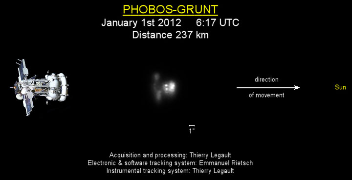
From Friday this week a three-tonne satellite is set to fall to Earth, the German Aerospace Agency DLR warned today.
The ROSAT satellite will re-enter between October 21st and 24th, scientists predict, and could strike anywhere on Earth between 53 degrees north and 53 degrees south - an area stretching from as far north as the UK to as far south as the Falkland Islands.
The agency calculates that there is a 1 in 2000 chance it will hit someone.
Fragments - including pieces of a heat-resistant mirror weighing 880lb - could hit anywhere within an 50 mile-wide path along the satellite's track.
Click image or URL to see ROSAT current predictions - position :
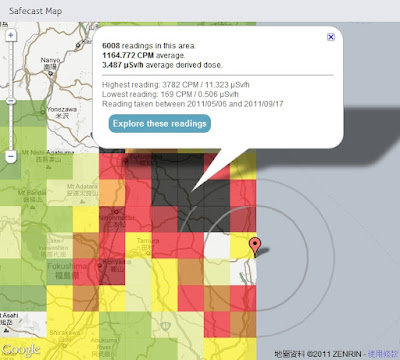
Safecast 於日本311強震後一週即建立起靜態及移動式監測網,目前已自政府及其他來源收集超過75萬點位監測資料並呈現在Google 地圖上,提供局部均值方塊圖(點擊Explore these readings 可看到詳細點位資料)及監測收集路線上所有點位輻射值並以顏色來區分不同強度。
Safecast was created one week after this year's Japanese earthquake in order to build a radiation sensor network of static and mobile sensors around Japan.
So far Safecast has collected over 750,000 data points which they have made accessible through a number of useful Google Maps. The Safecast Map depicts a heat map of the radiation readings. It is possible to select individual squares on the map and view the average readings.
Safecast have been driving across Japan in order to take radiation level readings. The data form each trip can be viewed on its own Google Map. The Safecast trips maps can be searched by location. In addition Safecast are aggregating radiation data from government and other sources. This data can be viewed on the Aggregate Map From All Sources.
Thailand is currently facing its worst flooding in 50 years. Flood waters have swamped more than two-thirds of the country, submerging rice fields and shutting down hundreds of factories while over 900,000 families and businesses have been impacted and hundreds of lives have been tragically lost. National relief efforts are now focused on providing essential food, clean water and shelter to displaced people and restoring damaged infrastructure to the Kingdom of Smiles.
圖層 Layers: Severely affected area: Urgent help needed Flooding Extents Satellite imagery Bangkok risk areas and water barriers Shelters Parking Areas Donations Flood affected areas across Thailand Flooded Highways Map more ......
View the conversations related to the recent demonstrations in New York and other cities in the US. Use the search and zoom tools to change the map area focus.