Dynamic View:
顯示具有 Earthquake 標籤的文章。 顯示所有文章

6/02/2012

被災地の上空写真を一刻も早く人々の手に(1) – 東日本大震災と情報、インターネット、Google

東日本大震災と情報、インターネット、Google

被災地の上空写真を一刻も早く人々の手に(1)


震災直後、被災地に家族や知人のいる人々は、焦燥に駆られた。津波はどこまで及んだのか? 家は流されていないか? Google は、人工衛星からの写真を提供することで人々の不安を少しでも和らげようとした。
2012 年 6 月 1 日掲載

衛星写真に記録された仙台空港の復興


Google Earth を起動し、時計のマークをクリックすると時間を巻き戻せるスライダが現れる。


Google Earth で最新状況を伝える
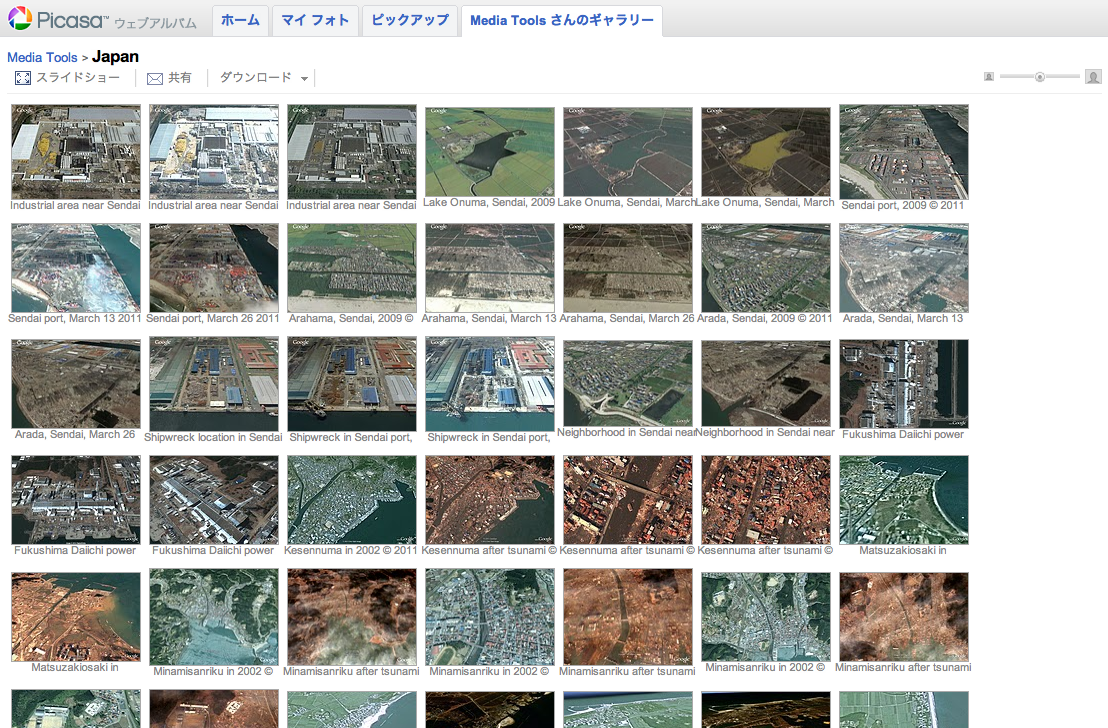
Picasa ウェブアルバム上で公開された衛星写真。


Google マップのマイマップから衛星写真を呼び出す

河合は Google マップのマイマップ機能を使って地図から該当する衛星写真を呼び出せるようにした。


Read More 続きを読む >> 被災地の上空写真を一刻も早く人々の手に(1) – 東日本大震災と情報、インターネット、Google


3/13/2012

日本311賑災捐款地圖 / Japan AID Map - See Where AID Went


JAPAN EARTHQUAKE AND TSUNAMI RELIEF

100% of all contributions received have been used exclusively to help people in Japan, supporting local Japanese organizations caring for the most vulnerable people affected by the earthquake and tsunami, with special focus on people with disabilities and the elderly.

  • $6 million from thousands of generous donors worldwide
  • $3.98 million in grants (66% of total funds raised) to 9 Japanese relief and recovery groups
  • 4% of total funds raised spent on program management and oversight
  • $1.8 million (30% of total funds raised) earmarked to support the long-term needs of the most vulnerable people 

THE EVENT  

On March 11, 2011, a magnitude-9.0 earthquake and subsequent tsunami and nuclear disaster struck northern Japan, killing over 16,000 people and leaving at least 3,000 missing. More than 5,400 people were injured and over 34,000 people were evacuated. The earthquake and tsunami damaged or destroyed more than 900,000 buildings. 

THE PARTNERSHIP  

Immediately following the disaster, Direct Relief and the Japanese American Citizen’s League (JACL) established the Japan Relief and Recovery Fund, committing 100% of all contributions to be used exclusively to help people in Japan in the most productive, efficient manner possible.


Read more >>

Here's where the aid went. (Interactive map)


日本地震和海嘯賑災

100% 收到的所有捐款已專款專用於幫助日本民眾,日本當地組織以關心受到地震和海嘯影響最脆弱者,尤其是殘疾和老人。

  • 世界各地 數以千計的慷慨捐助者600萬美元
  • 398萬美元的贈款(募集資金總額的66%)至9個救災和復災團體
  • 提高資金總額的4%於計畫管理和監督
  • 180萬美元(募集資金總額的30%),專門用於支持最脆弱人群的長期需求

12/13/2011

日本大地震(海嘯)前後街景比對 / Google Street View - Japan: Before and After the Earthquake and Tsunami

MEMORIES for the FUTURE
Japan: Before and After the Earthquake and Tsunami
Pre- and post-disaster imagery in Google Street View

未来へのキオク
いま、被災地をストリートビューで撮影しています。そして、過去の風景も大切に残します。


Before
After

Before
After


via: 未来へのキオクMEMORIES for the FUTURE

10/26/2011

土耳其7.2級強震 / Powerful earthquake strikes Turkey

土耳其東南部與伊朗接壤的凡城省23日發生黎克特制7.2級強震此次地震為土耳其12年來最強,震源深度僅10公里,屬淺層地震。土耳其位於歐亞板塊震帶,此地震帶近年地殼運動甚為活躍。地震發生於當地時間23日13時41分,震央位於塔班里村(Tabanli),靠近伊朗邊境。
美國地質調查局稱,地震震級為7.3級。當天晚些時候,土耳其方面將震級更正為7.2級。
除了與時間賽跑,營救受困人員外,當局目前最大的隱憂是,由於凡城位於土耳其第一大湖「凡湖」東岸,一旦大地震導致凡湖移位,大量湖水恐將灌入鄰近區域,使災情更加一發不可收拾。
土耳其位於歐亞板塊地震帶,是全球三大地震帶之一。地震主因是印度洋在印尼地區隱沒,印度半島向北與亞洲大陸發生碰撞,以及非洲大陸與歐亞大陸碰撞所造成。


The U.S. Geological Survey initially reported the quake had a magnitude of 7.3, then revised it down to 7.2.
Turkey is a tectonically active country that experiences frequent destructive earthquakes. On a broad scale, the seismtectonics of the region near the October 23, 2011 earthquake are controlled by the collision of the Arabian Plate and Eurasian plates; at the latitude of this event, the Arabian plate converges with Eurasia in a northerly direction at a rate of approximately 24 mm/yr. West of the October 23, 2011, earthquake tectonics are dominated by strike-slip faulting on the East (in southern Turkey) and North (in northern Turkey) Anatolian fault zones. These large, translational fault systems extend across much of central and western Turkey and accommodate the western motion of the Anatolian block as it is being squeezed by the converging Arabian and Eurasian plates.

Read alsoUnderstanding the 7.2 magnitude earthquake in East Turkey (October 23, 2011)

Read also New Insights into the October 2011 Van (Turkey) Earthquake – detailed analysis by the CEDIM Forensic Earthquake Analysis Group


Google Crisis Response : 2011 Turkey Eathquake, include Person Finder, Resources, Important Telephone Numbers, Maps and satellite imagery, News and Updates.
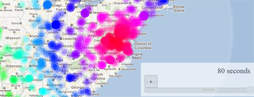
社群媒體地圖 / ESRI Social Media Map

Turkey Quake Map: Click to see animation

Click to see more Photos: Powerful earthquake strikes Turkey
7.2 Earthquake In Eastern Turkey 10-23-2011

CCTV shows moment when earthquake

Aerial of earthquake-hit Turkey shows full extent of damage

via: Earthquake-report, 星島日報

8/30/2011

Google Maps Mania: Measuring 10.6 on the Twitter Scale

美國維吉尼亞州發生5.8級強震, Twitter 訊息傳播的驚人速率、密度及範圍與地震P波幾乎一樣! 按播放鈕可於 Google Maps 上觀看實際 Twitter 傳播情形(80秒動畫)!
Monday, August 29, 2011
Measuring 10.6 on the Twitter Scale
Last week's Virginia earthquake may only have measured 5.8 on the Moment magnitude scale but it measured a whopping 10.6 on the Twitter scale.

This Twitter Quake Map shows the astonishing rate and spread of Twitter messages about the quake in the 8o seconds after it hit. As the map animates through the 80 seconds, the location and density of the Tweets radiate out from Virginia, almost exactly like the shock or P waves of the quake itself.

Via: @andreitr