
Monday, August 29, 2011
Measuring 10.6 on the Twitter Scale
Last week's Virginia earthquake may only have measured 5.8 on the Moment magnitude scale but it measured a whopping 10.6 on the Twitter scale.
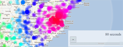
This Twitter Quake Map shows the astonishing rate and spread of Twitter messages about the quake in the 8o seconds after it hit. As the map animates through the 80 seconds, the location and density of the Tweets radiate out from Virginia, almost exactly like the shock or P waves of the quake itself.
Via: @andreitr